Throughout my college career, I have completed a number of large-scale projects that have helped me to learn new concepts and skills. Below is a subset of GIS and remote sensing-based projects that I have completed during the past three years. These projects are sorted chronologically which makes it easy to see my progression as a scientist and geospatial analyst over time.
Freshman and Sophomore Year
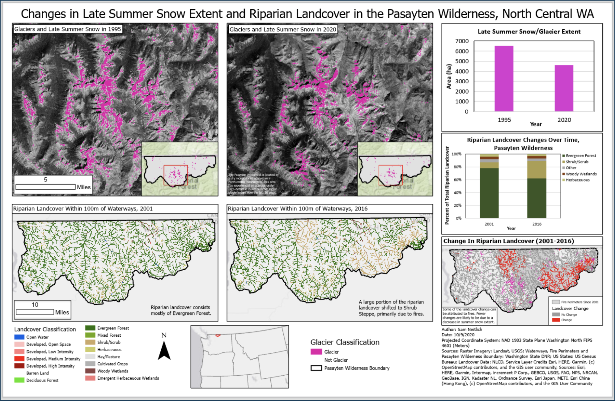
Predicting Burn Patterns and Glacial Retreat in North Central Washington
This two-part project involved analyzing patterns in fire activity and seasonal snow change over the past two decades in north central Washington State. Click here for more information about this project.
Here’s a map created as part of the glacier classification project.

Junior Year
Identifying Areas for Restoration with Remote Sensing
This project was based around using remote sensing to identify areas where conifers were encroaching into shrub steppe and deciduous forest and track riparian health and stream corridor movement over time in a Montana land trust. The results of this analysis were used to identify potential areas for restoration within the land trust. Click here for more information about this project.
Landscape Scale Snowpack Model in Alaskan National Parks
This project was centered around using satellite-derived data to model snow water equivalent (SWE) at a landscape scale in central Alaska. This analysis used an inverse logistic nonlinear regression model and was created primarily in Python. Click here for more information about this project.